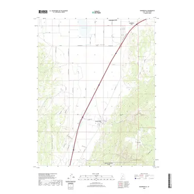
2020 Map of Kanarraville
USGS Topo · Published 2020About this map
Kanarraville sits at the foot of the dramatic Hurricane Cliffs, where the high desert plateau meets the eastern edge of the Cedar Valley. This landscape is defined by the sharp transition between the irrigated lowlands and the rugged terrain of the Harmony Mountains and Zion National Park. In the northern reach of the map, Cedar City and Hamiltons Fort represent the ongoing development of Iron County's historic corridor. Local genealogy is anchored at the Kanarraville Cem, while the hydrological pattern of the region is traced through Quichapa Cr, which feeds into Quichapa Lake. The arrangement of rural routes like Wheat Grass Ln and Old US Hwy 91 highlights the traditional agricultural and transit networks that have long connected these high-altitude settlements.
Find a feature on this map
47 named features on this map. Tap any name to fly to it.
Don’t see what you’re looking for? This feature index may not catch every label — zoom into the map to look around manually.
Map Details
Editions of this 2020 Kanarraville Map
This is the sole edition of this map. No revisions or reprints were ever made.
Other maps of this area

1885 · St. George
USGS Topo · 1:250,000

1891 · St. George
USGS Topo · 1:250,000

1949 · Cedar City NW
USGS Topo · 1:24,000

1950 · Cedar City NW
USGS Topo · 1:24,000

1950 · Kanarraville
USGS Topo · 1:24,000

1950 · Cedar City
USGS Topo · 1:24,000

1950 · Iron Mountain
USGS Topo · 1:62,500

1950 · Cedar City
USGS Topo · 1:62,500

1950 · Cedar Mountain
USGS Topo · 1:24,000

1950 · Stoddard Mtn
USGS Topo · 1:24,000