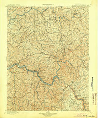
1901 Map of Kanawha Falls
USGS Topo · Published 1904About this map
The Kanawha River and Gauley River converge in a landscape defined by deep river valleys and early industrial hubs at the end of the nineteenth century. Surveyed in 1895, this sheet captures the essential rail infrastructure of the Chesapeake and Ohio RR and Kanawha and Michigan RR as they follow the riverbanks through major coal and transport centers like Montgomery, Cannelton, and Cedar Grove. The northern reaches along the Elk River show smaller riverside settlements such as Clendenin and Queen Shoal, separated from the southern industrial corridor by high peaks including Bird Knob and Mt. Desert. This mapping provides a look at the region before modern development, identifying early river locks like Lock 2 and numerous family-named landmarks such as Carnes Knob and Johnson Knob that serve as vital coordinates for genealogists tracing West Virginia family history.
Find a feature on this map
111 named features on this map. Tap any name to fly to it.
Don’t see what you’re looking for? This feature index may not catch every label — zoom into the map to look around manually.
Map Details
Editions of this 1901 Kanawha Falls Map
3 editions found

Other maps of this area

1887 · Hinton
USGS Topo · 1:125,000

1889 · Nicholas
USGS Topo · 1:125,000

1891 · Nicholas
USGS Topo · 1:125,000

1891 · Oceana
USGS Topo · 1:125,000

1891 · Raleigh
USGS Topo · 1:125,000

1892 · Hinton
USGS Topo · 1:125,000

1893 · Oceana
USGS Topo · 1:125,000

1893 · Sutton
USGS Topo · 1:125,000

1897 · Kanawha Falls
USGS Topo · 1:125,000

1897 · Raleigh
USGS Topo · 1:125,000