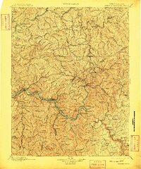
1901 Map of Kanawha Falls
USGS Topo · Published 1909About this map
The Elk River and Kanawha River corridors define this 1895 survey, which was reprinted just after the first decade of the twentieth century. Industrial activity is concentrated along the riverbanks, where the Chesapeake and Ohio and Kanawha and Michigan railroads provide critical transport for coal and manufacturing. Settlements like Cedargrove, Coalburg, and Montgomery line the water, while infrastructure like Lock 2 and a Ferry near Jarrett show the vital role of river navigation.
Find a feature on this map
192 named features on this map. Tap any name to fly to it.
Don’t see what you’re looking for? This feature index may not catch every label — zoom into the map to look around manually.
Map Details
Editions of this 1901 Kanawha Falls Map
3 editions found

Other maps of this area

1887 · Hinton
USGS Topo · 1:125,000

1889 · Nicholas
USGS Topo · 1:125,000

1891 · Nicholas
USGS Topo · 1:125,000

1891 · Oceana
USGS Topo · 1:125,000

1891 · Raleigh
USGS Topo · 1:125,000

1892 · Hinton
USGS Topo · 1:125,000

1893 · Oceana
USGS Topo · 1:125,000

1893 · Sutton
USGS Topo · 1:125,000

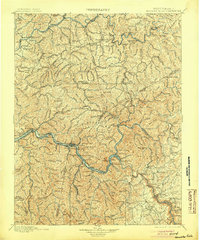
1897 · Kanawha Falls
USGS Topo · 1:125,000

1897 · Raleigh
USGS Topo · 1:125,000