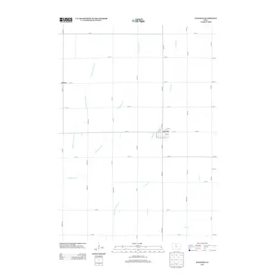
2013 Map of Kanawha
USGS Topo · Published 2013About this map
Kanawha serves as the central hub of this Hancock County landscape, laid out in a precise grid system typical of north-central Iowa's agricultural heartland. The town's structure is defined by streets like N Main St and E 5th St, surrounded by a vast network of section roads such as Ida Ave and 140th St. To the west, the settlement of Denhart sits near the winding paths of the Middle Br Boone River and the E Br Boone River. This terrain is heavily shaped by water management, evidenced by the presence of Drainage Ditch Number 107 and various branches of Otter Cr. The landscape illustrates the intensive agricultural development of the region, where natural waterways and engineered drainage systems coexist to support the rural economy during the early 21st century.
Find a feature on this map
40 named features on this map. Tap any name to fly to it.
Don’t see what you’re looking for? This feature index may not catch every label — zoom into the map to look around manually.
Map Details
Editions of this 2013 Kanawha Map
This is the sole edition of this map. No revisions or reprints were ever made.
Other maps of this area

1954 · Mason City
USGS Topo · 1:250,000

1954 · Waterloo
USGS Topo · 1:250,000

1955 · Waterloo
USGS Topo · 1:250,000

1957 · Mason City
USGS Topo · 1:250,000

1958 · Mason City
USGS Topo · 1:250,000

1972 · Kanawha SE
USGS Topo · 1:24,000

1972 · Cornelia
USGS Topo · 1:24,000

1972 · Corwith
USGS Topo · 1:24,000

1972 · Kanawha
USGS Topo · 1:24,000

1972 · Olaf
USGS Topo · 1:24,000