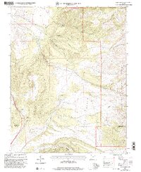
2001 Map of Kane Canyon
USGS Topo · Published 2003About this map
Fishlake National Forest encompasses the eastern portion of this high-elevation terrain, where the Hurricane Cliffs create a dramatic transition in the south. The landscape is defined by a complex network of drainages and canyons, most notably Kane Canyon and its various branches like South Fork Kane Canyon. Local infrastructure is sparse, characterized by isolated technical sites such as a Communication Site on Beaver Ridge and a Gaging Station located near Big Twist Creek.
Find a feature on this map
36 named features on this map. Tap any name to fly to it.
Don’t see what you’re looking for? This feature index may not catch every label — zoom into the map to look around manually.
Map Details
Editions of this 2001 Kane Canyon Map
This is the sole edition of this map. No revisions or reprints were ever made.
Other maps of this area

1885 · Beaver
USGS Topo · 1:250,000

1937 · Delano Peak
USGS Topo · 1:48,000

1943 · Delano Peak
USGS Topo · 1:62,500

1953 · Richfield
USGS Topo · 1:250,000

1954 · Beaver SE
USGS Topo · 1:24,000

1958 · Richfield
USGS Topo · 1:250,000

1958 · Beaver
USGS Topo · 1:62,500

1966 · Fremont Pass
USGS Topo · 1:24,000

1971 · Buckhorn Flat
USGS Topo · 1:24,000
1971 · Burnt Peak
USGS Topo · 1:24,000