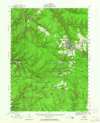
1934 Map of Kane
USGS Topo · Published 1964About this map
Kinzua Creek and the South Branch Kinzua Creek carve deep valleys through this portion of the Allegheny Plateau during the mid-1930s. The industrial character of the region is evident in the dense network of the Pennsylvania and Baltimore And Ohio railroads, which connect scattered timber and industrial settlements like James City and Ludlow. The map reveals the social infrastructure of the era, from the Northwestern Sch and Greendale Sch serving the borough of Kane, to the presence of a CCC Camp and Crystal Mineral Springs. For genealogists, the identification of smaller settlements like Windy City, McKinley, and Russell City De Young P.O. provides a precise geographical record of communities that supported the local extraction and manufacturing economies. This landscape reflects a moment when railroad transit still dictated the location of remote outposts like Sergeant and Dahoga before the modern highway system fully decentralized the region.
Find a feature on this map
88 named features on this map. Tap any name to fly to it.
Don’t see what you’re looking for? This feature index may not catch every label — zoom into the map to look around manually.
Map Details
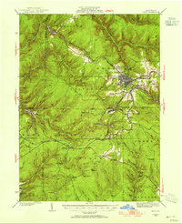
Editions of this 1934 Kane Map
3 editions found
Other maps of this area

1906 · Warren
USGS Topo · 1:62,500

1907 · Warren
USGS Topo · 1:62,500

1908 · Warren
USGS Topo · 1:62,500

1918 · Loleta
USGS Topo · 1:62,500

1924 · Bradford
USGS Topo · 1:62,500

1926 · Bradford
USGS Topo · 1:62,500

1934 · Kane
USGS Topo · 1:48,000

1935 · Sheffield
USGS Topo · 1:48,000

1935 · Mt. Jewett
USGS Topo · 1:48,000

1936 · Kinzua
USGS Topo · 1:48,000
Featured Places
- Kane, PA
- Sheffield Township, PA
- Wetmore, Hamilton Township
- Sergeant, Wetmore Township
- Lamont, Jones Township