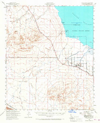
1940 Map of Kane Spring
USGS Topo · Published 1967About this map
The Salton Sea shoreline dominates the northeastern corner of this 1940 survey, where the Salton Sea National Wildlife Refuge provides a sanctuary amidst the arid Colorado Desert. This era shows the early development of small agricultural and recreational outposts like Sea View Beach and Sandy Beach, while the interior remains a landscape of industrial exploration and water management. Landmarks such as the Diamond Bar Test Well, Harpers Well, and the Mesquite Drill Hole signal the search for resources in the harsh terrain. Further south, the Roosevelt Sch and the Elmore Desert Ranch represent the sparse but determined settlement of the Lower Borrego Valley. Transportation is defined by the Pacific Portland Cement Co RR skirting the Superstition Hills and numerous washes like San Felipe Creek that carve through the desert floor.
Find a feature on this map
25 named features on this map. Tap any name to fly to it.
Don’t see what you’re looking for? This feature index may not catch every label — zoom into the map to look around manually.
Map Details
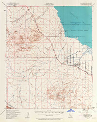
Editions of this 1940 Kane Spring Map
3 editions found
Other maps of this area

1904 · Indio
USGS Topo · 1:125,000

1915 · El Centro
USGS Topo · 1:125,000

1931 · Vallecito
USGS Topo · 1:125,000

1931 · Carrizo
USGS Topo · 1:125,000

1940 · Brawley
USGS Topo · 1:62,500

1940 · Kane Spring
USGS Topo · 1:62,500

1940 · Frink
USGS Topo · 1:62,500

1940 · Plaster City
USGS Topo · 1:62,500

1940 · Durmid
USGS Topo · 1:62,500

1942 · Barrel Spring
USGS Topo · 1:62,500