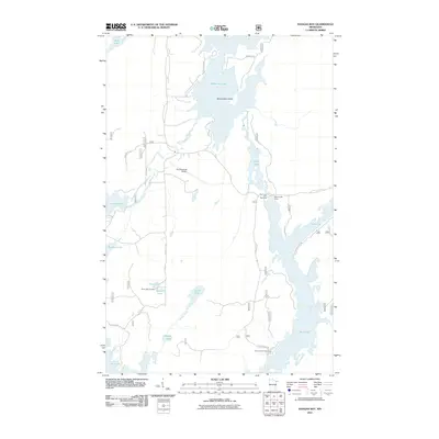
2011 Map of Kangas Bay
USGS Topo · Published 2011About this map
White Iron Lake and the winding South Kawishiwi River dominate this portion of the Iron Range backcountry at the beginning of the 21st century. The map centers on the massive Beargrease Island, where the river network flows into a complex system of interconnected water bodies including Birch Lake. This environment is defined by its recreation and aviation infrastructure, notably the Ely Municipal Airport and the Birch Lake Dam. For those tracing local families, the Birch Lake Cemetery sits near the shores of Pearl Lake and Hanson Lake. The landscape is etched with local access routes like Latvia Rd and Ringrock Rd, while the Birch Lake Campground serves as a modern anchor for the unorganized territory's seasonal population.
Find a feature on this map
29 named features on this map. Tap any name to fly to it.
Don’t see what you’re looking for? This feature index may not catch every label — zoom into the map to look around manually.
Map Details
Editions of this 2011 Kangas Bay Map
This is the sole edition of this map. No revisions or reprints were ever made.
Other maps of this area

1933 · Ely
USGS Topo · 1:62,500

1939 · Ely
USGS Topo · 1:62,500

1951 · Babbitt
USGS Topo · 1:24,000

1952 · Babbitt NE
USGS Topo · 1:24,000

1954 · Greenwood Lake
USGS Topo · 1:62,500

1954 · Two Harbors
USGS Topo · 1:250,000

1957 · Two Harbors
USGS Topo · 1:250,000

1957 · Gabbro Lake
USGS Topo · 1:62,500

1958 · Two Harbors
USGS Topo · 1:250,000
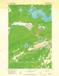
1962 · Babbitt
USGS Topo · 1:24,000
Featured Places
- Birch Lake (Unorganized Territory), MN
- Morse Township, MN
- Fall Lake Township, MN
- Stony River Township, MN
- Saint Louis County, MN