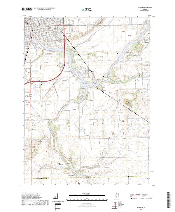
2024 Map of Kankakee
USGS Topo · Published 2024About this map
The Kankakee River and Iroquois River converge in this Illinois landscape, anchoring a regional hub defined by its civic institutions and riverfront settlements. In Kankakee, the Kankakee County Courthouse sits at the heart of the grid, while the Illinois Central RR and Norfolk Southern RR corridors reflect the area's long-standing role as a transportation nexus. Notable for genealogists, the map identifies several distinct burial grounds, including the Old State Hospital Cem and the Beebe Family Cem. To the south, smaller communities like Aroma Park, Sammons Point, and Sugar Island follow the river bends, while Mt Langham provides a notable topographic contrast to the surrounding drainage of Exline Slough and Minnie Creek.
Find a feature on this map
107 named features on this map. Tap any name to fly to it.
Don’t see what you’re looking for? This feature index may not catch every label — zoom into the map to look around manually.
Map Details
Editions of this 2024 Kankakee Map
This is the sole edition of this map. No revisions or reprints were ever made.
Other maps of this area

1922 · Momence
USGS Topo · 1:62,500

1922 · Kankakee
USGS Topo · 1:62,500

1924 · Momence
USGS Topo · 1:62,500

1924 · Kankakee
USGS Topo · 1:62,500

1935 · Watseka
USGS Topo · 1:48,000

1939 · Watseka
USGS Topo · 1:62,500

1944 · Gilman
USGS Topo · 1:62,500

1946 · Gilman
USGS Topo · 1:62,500

1953 · Chicago
USGS Topo · 1:250,000

1953 · Danville
USGS Topo · 1:250,000