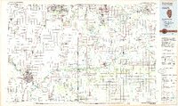
1984 Map of Kankakee
USGS Topo · Published 1985About this map
The Kankakee River and Iroquois River anchor this 1980s landscape, serving as the primary drainage and historical corridors for a region spanning the Illinois and Indiana state line. In the west, the growing urban center around Kankakee, Bourbonnais, and Bradley reflects the industrial and educational presence of the era, including Olivet Nazarene College and the sprawling grounds of the Kankakee State Hospital. Further north, the Manteno State Hospital stands as a significant landmark of social infrastructure near Manteno.
Find a feature on this map
232 named features on this map. Tap any name to fly to it.
Don’t see what you’re looking for? This feature index may not catch every label — zoom into the map to look around manually.
Map Details
Editions of this 1984 Kankakee Map
This is the sole edition of this map. No revisions or reprints were ever made.
Other maps of this area

1890 · Des Plaines
USGS Topo · 1:62,500

1892 · Joliet
USGS Topo · 1:62,500

1892 · Calumet
USGS Topo · 1:62,500

1892 · Wilmington
USGS Topo · 1:62,500

1893 · Calumet
USGS Topo · 1:62,500

1894 · Des Plaines
USGS Topo · 1:62,500

1900 · Des Plaines
USGS Topo · 1:62,500

1900 · Toleston
USGS Topo · 1:62,500

1900 · Calumet
USGS Topo · 1:62,500

1901 · Calumet
USGS Topo · 1:62,500