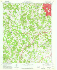
1969 Map of Kannapolis
USGS Topo · Published 1972About this map
Kannapolis serves as the primary urban center in this survey, defined by its red-tinted grid and the busy Southern railroad line passing through the town of Glass. The surrounding landscape is characterized by a high density of rural institutions, particularly along the Mecklenburg Co Cabarrus Co boundary. Genealogists will find a wealth of named local landmarks, including Bethpage Ch Cem, Shady Brook Sch, and Poplar Tent Ch.
Find a feature on this map
47 named features on this map. Tap any name to fly to it.
Don’t see what you’re looking for? This feature index may not catch every label — zoom into the map to look around manually.
Map Details
Editions of this 1969 Kannapolis Map
2 editions found
Other maps of this area

1893 · Statesville
USGS Topo · 1:125,000

1941 · Charlotte
USGS Topo · 1:125,000

1942 · Charlotte
USGS Topo · 1:125,000

1948 · Derita
USGS Topo · 1:24,000

1949 · Kannapolis
USGS Topo · 1:24,000

1949 · Harrisburg
USGS Topo · 1:24,000

1949 · Concord SE
USGS Topo · 1:24,000

1950 · Concord
USGS Topo · 1:24,000

1953 · Charlotte
USGS Topo · 1:250,000

1954 · Charlotte
USGS Topo · 1:250,000