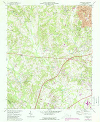
1969 Map of Kannapolis
USGS Topo · Published 1988About this map
Kannapolis serves as the primary urban center on this terrain, where the sprawling textile-era grid of the town meet the rural landscape of the Cabarrus Co and Mecklenburg Co border. The map documents a countryside defined by small rural hubs and historical religious landmarks, including Bethpage Ch, Poplar Tent Ch, and Shiloh Ch. These spiritual and social centers are connected by a network of winding roads that follow the drainage patterns of Coddle Creek and the Rocky River.
Find a feature on this map
44 named features on this map. Tap any name to fly to it.
Don’t see what you’re looking for? This feature index may not catch every label — zoom into the map to look around manually.
Map Details
Editions of this 1969 Kannapolis Map
2 editions found
Other maps of this area

1893 · Statesville
USGS Topo · 1:125,000

1941 · Charlotte
USGS Topo · 1:125,000

1942 · Charlotte
USGS Topo · 1:125,000

1948 · Derita
USGS Topo · 1:24,000

1949 · Kannapolis
USGS Topo · 1:24,000

1949 · Harrisburg
USGS Topo · 1:24,000

1949 · Concord SE
USGS Topo · 1:24,000

1950 · Concord
USGS Topo · 1:24,000

1953 · Charlotte
USGS Topo · 1:250,000

1954 · Charlotte
USGS Topo · 1:250,000