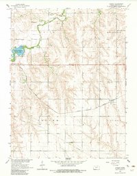
1965 Map of Kanona
USGS Topo · Published 1983About this map
Kanona serves as a focal point for this western Kansas landscape, situated where the Chicago Burlington and Quincy railroad cuts across the prairie. The topography is defined by the drainages of Sappa Creek, Rock Creek, and Cottonwood Creek, which carve deep draws through the surrounding townships of Olive, Roosevelt, Center, and Altory. In the western portion of the map, the Oberlin-Sappa State Park provides a notable recreational landmark with its prominent spillway. The economy of the mid-1960s is evidenced by several scattered oil wells and gravel pits, alongside a major pipeline corridor. Genealogists will find the Kanona Cem east of the main settlement, a quiet fixture in this agricultural region during the post-war era.
Find a feature on this map
15 named features on this map. Tap any name to fly to it.
Don’t see what you’re looking for? This feature index may not catch every label — zoom into the map to look around manually.
Map Details
Editions of this 1965 Kanona Map
2 editions found
Other maps of this area

1951 · Selden
USGS Topo · 1:62,500

1951 · Oberlin
USGS Topo · 1:62,500

1951 · Kanona
USGS Topo · 1:62,500

1954 · Goodland
USGS Topo · 1:250,000

1956 · Goodland
USGS Topo · 1:250,000

1957 · Goodland
USGS Topo · 1:250,000

1965 · Kanona SE
USGS Topo · 1:24,000

1965 · Oberlin
USGS Topo · 1:24,000

1965 · Kanona
USGS Topo · 1:24,000
1965 · Kanona NW
USGS Topo · 1:24,000