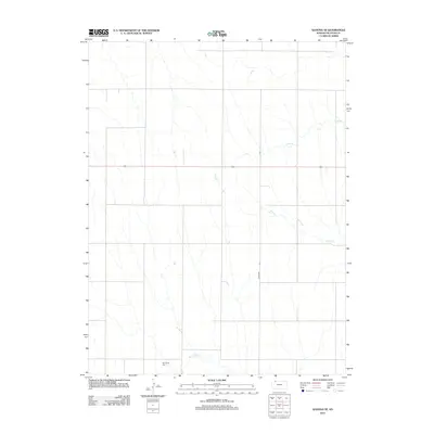
2012 Map of Kanona SE
USGS Topo · Published 2012About this map
Big Timber Cem stands as a quiet landmark in this section of Decatur County, situated near the headwaters of Big Timber Cr. This part of the High Plains is defined by its rectilinear road grid and the seasonal drainages that break the agricultural plateau. Notable waterways like Long Br and Plum Cr carve subtle variations into the landscape, while arterial routes like 36 and the north-south transit of Co Rd 509 facilitate movement across the rural expanse. The map illustrates a highly organized land-use pattern typical of the western Kansas prairie, where farmstead access and drainage management are central to the local geography.
Find a feature on this map
6 named features on this map. Tap any name to fly to it.
Don’t see what you’re looking for? This feature index may not catch every label — zoom into the map to look around manually.
Map Details
Editions of this 2012 Kanona SE Map
This is the sole edition of this map. No revisions or reprints were ever made.
Other maps of this area

1951 · Norcatur
USGS Topo · 1:62,500

1951 · Kanona
USGS Topo · 1:62,500

1954 · Goodland
USGS Topo · 1:250,000

1956 · Goodland
USGS Topo · 1:250,000

1957 · Goodland
USGS Topo · 1:250,000

1965 · Kanona SE
USGS Topo · 1:24,000

1965 · Kanona
USGS Topo · 1:24,000
1965 · Lyle
USGS Topo · 1:24,000
1965 · Kanona NW
USGS Topo · 1:24,000
1965 · Kanona NE
USGS Topo · 1:24,000