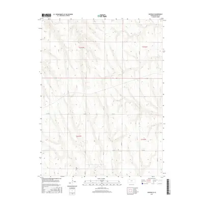
2015 Map of Kanona SE
USGS Topo · Published 2015About this map
Big Timber Cem sits near the southern edge of this Decatur County landscape, serving as a primary point of interest for genealogists tracing early plains families. The terrain is defined by the winding drainages of Big Timber Cr, Plum Cr, and Long Br, which carve subtle valleys through the high Kansas prairie. This U.S. Geological Survey sheet illustrates the strict grid of the Public Land Survey System, where section lines are faithfully followed by local routes like Co Rd 495 and Co Rd 509. The map documents the rural infrastructure of the early 21st century, showing the intersection of long-established township boundaries like t2s r27w and t3s r27w with the modern numbering of 2300th Rd and 2400th Rd.
Find a feature on this map
22 named features on this map. Tap any name to fly to it.
Don’t see what you’re looking for? This feature index may not catch every label — zoom into the map to look around manually.
Map Details
Editions of this 2015 Kanona SE Map
This is the sole edition of this map. No revisions or reprints were ever made.
Other maps of this area

1951 · Norcatur
USGS Topo · 1:62,500

1951 · Kanona
USGS Topo · 1:62,500

1954 · Goodland
USGS Topo · 1:250,000

1956 · Goodland
USGS Topo · 1:250,000

1957 · Goodland
USGS Topo · 1:250,000

1965 · Kanona SE
USGS Topo · 1:24,000

1965 · Kanona
USGS Topo · 1:24,000
1965 · Lyle
USGS Topo · 1:24,000
1965 · Kanona NW
USGS Topo · 1:24,000
1965 · Kanona NE
USGS Topo · 1:24,000