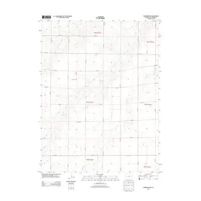
2013 Map of Kanorado NW
USGS Topo · Published 2013About this map
Beaver Creek and its various tributaries define the hydrology of this High Plains landscape in northeastern Colorado. The area is characterized by a strict orthogonal grid of rural thoroughfares, such as Co Road JJ and Co Road 50, which follow the section lines of the Public Land Survey System. These roads carve the terrain into predictable square-mile blocks, typical of the agricultural development in Kit Carson County. Watercourses like Little Beaver Cr and Bonny Cr provide the only natural deviation from this geometric order, cutting winding paths across the township and range boundaries of t007s r043w. This 2013 survey illustrates a modern rural infrastructure where the land is primarily managed for large-scale farming and ranching, evidenced by the absence of dense town sites in favor of expansive, open country.
Find a feature on this map
27 named features on this map. Tap any name to fly to it.
Don’t see what you’re looking for? This feature index may not catch every label — zoom into the map to look around manually.
Map Details
Editions of this 2013 Kanorado NW Map
This is the sole edition of this map. No revisions or reprints were ever made.
Other maps of this area

1950 · Bonny Reservoir
USGS Topo · 1:62,500

1954 · Limon
USGS Topo · 1:250,000

1957 · Limon
USGS Topo · 1:250,000

1958 · Limon
USGS Topo · 1:250,000

1969 · Kanorado NE
USGS Topo · 1:24,000

1969 · Burlington
USGS Topo · 1:24,000

1969 · Idalia SE
USGS Topo · 1:24,000

1969 · Peconic
USGS Topo · 1:24,000

1969 · Kanorado NW
USGS Topo · 1:24,000
1969 · Burlington NE
USGS Topo · 1:24,000