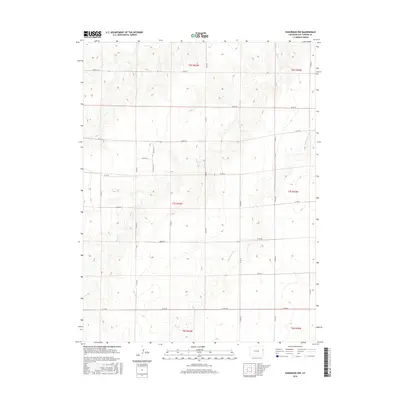
2016 Map of Kanorado NW
USGS Topo · Published 2016About this map
Little Beaver Creek and its neighboring drainage, Beaver Creek, shape the undulating landscape of this corner of Kit Carson County. The map reveals a strictly regulated grid of section lines and county roads that define the agricultural character of eastern Colorado. This network of thoroughfares, including Co Rd BB and Co Rd JJ, connects the sprawling townships of Township 7 South, Range 43 West and Township 7 South, Range 42 West. The presence of ephemeral watercourses like Bonny Creek in the north highlights the subtle variations in elevation that dictate the placement of ranching infrastructure and rural homesteads in this dryland environment.
Find a feature on this map
27 named features on this map. Tap any name to fly to it.
Don’t see what you’re looking for? This feature index may not catch every label — zoom into the map to look around manually.
Map Details
Editions of this 2016 Kanorado NW Map
This is the sole edition of this map. No revisions or reprints were ever made.
Other maps of this area

1950 · Bonny Reservoir
USGS Topo · 1:62,500

1954 · Limon
USGS Topo · 1:250,000

1957 · Limon
USGS Topo · 1:250,000

1958 · Limon
USGS Topo · 1:250,000

1969 · Kanorado NE
USGS Topo · 1:24,000

1969 · Burlington
USGS Topo · 1:24,000

1969 · Idalia SE
USGS Topo · 1:24,000

1969 · Peconic
USGS Topo · 1:24,000

1969 · Kanorado NW
USGS Topo · 1:24,000
1969 · Burlington NE
USGS Topo · 1:24,000