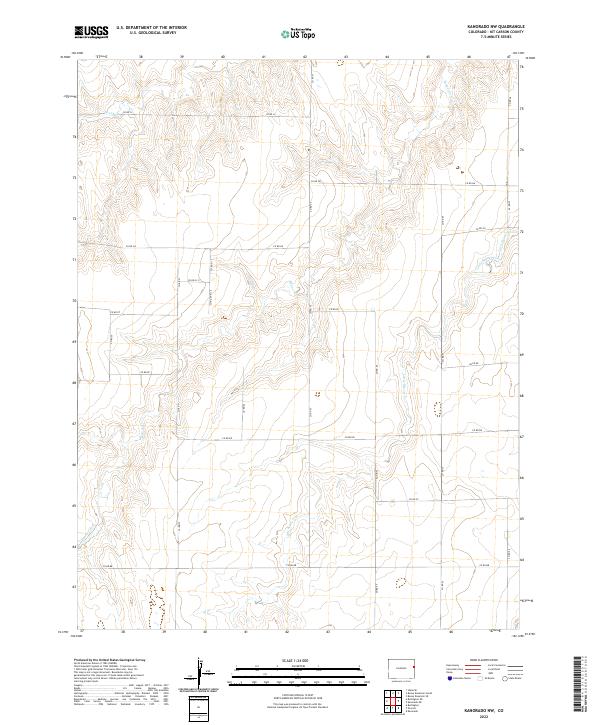
2022 Map of Kanorado NW
USGS Topo · Published 2022About this map
The drainage basins of Beaver Creek and Little Beaver Creek dominate this section of the High Plains in Kit Carson County. The map illustrates a strictly organized agricultural landscape, where the Jeffersonian grid system is realized through an extensive network of county roads including Co RD 53 and Co RD 56. These roads serve as the primary infrastructure for the sparsely distributed ranching and farming operations across townships such as t6s r43w and t7s r43w. The terrain is defined by the gentle erosion patterns of the creek beds, which provide the only significant break in the otherwise uniform plateau. This document captures the modern state of land division in eastern Colorado, showing how the original land survey system continues to dictate the movement and settlement patterns of the region well into the 21st century.
Find a feature on this map
28 named features on this map. Tap any name to fly to it.
Don’t see what you’re looking for? This feature index may not catch every label — zoom into the map to look around manually.
Map Details
Editions of this 2022 Kanorado NW Map
This is the sole edition of this map. No revisions or reprints were ever made.
Other maps of this area

1950 · Bonny Reservoir
USGS Topo · 1:62,500

1954 · Limon
USGS Topo · 1:250,000

1957 · Limon
USGS Topo · 1:250,000

1958 · Limon
USGS Topo · 1:250,000

1969 · Kanorado NE
USGS Topo · 1:24,000

1969 · Burlington
USGS Topo · 1:24,000

1969 · Idalia SE
USGS Topo · 1:24,000

1969 · Peconic
USGS Topo · 1:24,000

1969 · Kanorado NW
USGS Topo · 1:24,000
1969 · Burlington NE
USGS Topo · 1:24,000