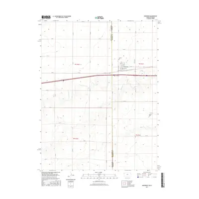
2015 Map of Kanorado
USGS Topo · Published 2015About this map
Kanorado stands as a pivotal border settlement on the high plains, situated directly on the state line where the Colorado Kansas boundary separates Sherman County from Kit Carson County. The town's grid is defined by streets such as Main St and Railroad St, reflecting its historical development alongside the rail corridor. This mid-2010s survey illustrates a landscape of large-scale agricultural blocks partitioned by an extensive network of county roads, including Co Rd AA and Co Rd S. Local genealogy and history are anchored by the Kanorado Cem north of town and the Kanorado Catholic Cem to the southeast. The terrain is subtly carved by the drainage of Middle Beaver Cr and S Beaver Cr, which provide the only significant breaks in the geometric regularity of the surrounding farmland.
Find a feature on this map
38 named features on this map. Tap any name to fly to it.
Don’t see what you’re looking for? This feature index may not catch every label — zoom into the map to look around manually.
Map Details
Editions of this 2015 Kanorado Map
This is the sole edition of this map. No revisions or reprints were ever made.
Other maps of this area

1954 · Limon
USGS Topo · 1:250,000

1954 · Goodland
USGS Topo · 1:250,000

1956 · Goodland
USGS Topo · 1:250,000

1957 · Limon
USGS Topo · 1:250,000

1957 · Goodland
USGS Topo · 1:250,000

1958 · Limon
USGS Topo · 1:250,000

1959 · Horsethief Draw
USGS Topo · 1:62,500

1966 · Ruleton NW
USGS Topo · 1:24,000

1966 · Ruleton
USGS Topo · 1:24,000

1969 · Kanorado NE
USGS Topo · 1:24,000