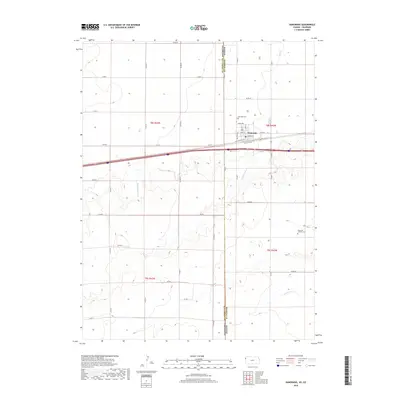
2018 Map of Kanorado
USGS Topo · Published 2018About this map
Kanorado sits directly on the high plains border between Kansas and Colorado, a location defined by its history as a transit point for travelers and local agricultural trade. The grid of the town is anchored by Front St and Center St, while the northern edge is bounded by N Railroad St, marking the significance of the rail corridor to this community. North of the town center lies the Kanorado Cem, providing a focal point for genealogical research in Sherman County. The surrounding landscape is characterized by the subtle drainages of Middle Beaver Cr and S Beaver Cr, which weave through the agricultural sections. In the southeastern portion of the map, the Kanorado Catholic Cem stands as another important landmark for local family history. Traces of early transcontinental travel are evident in the path of Old US Hwy 24, which parallels the modern interstate, serving as a reminder of the era of early highway development before the contemporary freeway system.
Find a feature on this map
28 named features on this map. Tap any name to fly to it.
Don’t see what you’re looking for? This feature index may not catch every label — zoom into the map to look around manually.
Map Details
Editions of this 2018 Kanorado Map
This is the sole edition of this map. No revisions or reprints were ever made.
Other maps of this area

1954 · Limon
USGS Topo · 1:250,000

1954 · Goodland
USGS Topo · 1:250,000

1956 · Goodland
USGS Topo · 1:250,000

1957 · Limon
USGS Topo · 1:250,000

1957 · Goodland
USGS Topo · 1:250,000

1958 · Limon
USGS Topo · 1:250,000

1959 · Horsethief Draw
USGS Topo · 1:62,500

1966 · Ruleton NW
USGS Topo · 1:24,000

1966 · Ruleton
USGS Topo · 1:24,000

1969 · Kanorado NE
USGS Topo · 1:24,000