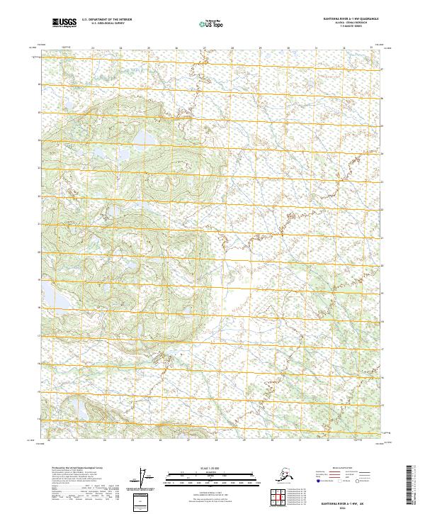
2024 Map of Kantishna River A-1 NW
USGS Topo · Published 2024About this map
Untouched subarctic lowlands and shifting riverine wetlands dominate this quadrangle in the Denali Borough of Alaska. The landscape is defined by a complex mosaic of marshes and small water bodies, as recorded by the National Wetlands Inventory. The absence of named settlements or infrastructure reflects the wilderness character of the region within the Public Land Survey System areas of T8s R15w, T8s R14w, T9s R15w, and T9s R14w. Topographic relief is subtle, characterized by gentle elevations and vast stretches of hydrologically active terrain that shape the drainage patterns of the Kantishna River basin.
Find a feature on this map
4 named features on this map. Tap any name to fly to it.
Don’t see what you’re looking for? This feature index may not catch every label — zoom into the map to look around manually.
Map Details
Editions of this 2024 Kantishna River A-1 NW Map
This is the sole edition of this map. No revisions or reprints were ever made.
Other maps of this area

1948 · Kantishna River
USGS Topo · 1:250,000

1951 · Kantishna River
USGS Topo · 1:250,000

1952 · Kantishna River A-1
USGS Topo · 1:63,360

1952 · Kantishna River
USGS Topo · 1:250,000

1952 · Kantishna River A-2
USGS Topo · 1:63,360

1952 · Kantishna River B-1
USGS Topo · 1:63,360

1953 · Kantishna River B-2
USGS Topo · 1:63,360
1953 · Kantishna River A-1
USGS Topo · 1:63,360

1964 · Kantishna River
USGS Topo · 1:250,000
2017 · Kantishna River A-2 SE
USGS Topo · 1:25,000