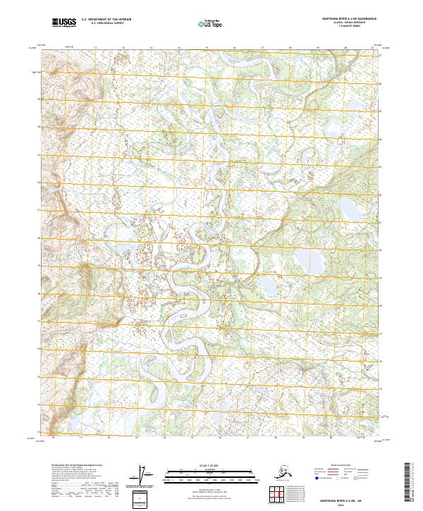
2024 Map of Kantishna River A-2 NE
USGS Topo · Published 2024About this map
Kantishna River meanders through this interior Alaska landscape, defining a complex network of oxbow lakes and wetlands. The river's serpentine path is the dominant geographical feature of the region, which is also fed by Chitsia Creek in the southern reaches. This topographic record shows an environment shaped almost entirely by natural hydrological forces rather than human development. The absence of roads or established settlements highlights the remote character of this terrain within the t8s r15w and t9s r16w townships. For those tracking the shifting course of Arctic waterways or studying the drainage patterns of the Denali region, the map provides precise data on elevation and water distribution across this undisturbed wilderness.
Find a feature on this map
6 named features on this map. Tap any name to fly to it.
Don’t see what you’re looking for? This feature index may not catch every label — zoom into the map to look around manually.
Map Details
Editions of this 2024 Kantishna River A-2 NE Map
This is the sole edition of this map. No revisions or reprints were ever made.
Other maps of this area

1948 · Kantishna River
USGS Topo · 1:250,000

1951 · Kantishna River
USGS Topo · 1:250,000

1952 · Kantishna River A-1
USGS Topo · 1:63,360

1952 · Kantishna River
USGS Topo · 1:250,000

1952 · Kantishna River A-2
USGS Topo · 1:63,360

1952 · Kantishna River B-1
USGS Topo · 1:63,360

1953 · Kantishna River B-2
USGS Topo · 1:63,360
1953 · Kantishna River A-1
USGS Topo · 1:63,360

1964 · Kantishna River
USGS Topo · 1:250,000
2017 · Kantishna River A-2 SE
USGS Topo · 1:25,000