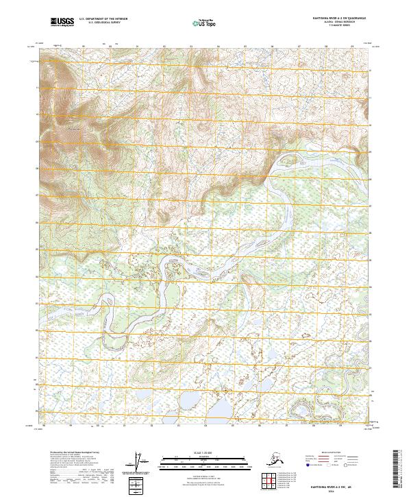
2024 Map of Kantishna River A-2 SW
USGS Topo · Published 2024About this map
Kantishna River meanders through a vast network of wetlands and alluvial flats in this remote portion of Denali Borough. The waterway dominates the central and southern reaches of the quadrangle, characterized by intricate oxbows and shifting channels that define the interior Alaskan landscape. To the northwest, the terrain rises toward Bearpaw Mtn, providing a distinct topographical contrast to the saturated lowlands below. The Bearpaw River enters from the southeast, its course weaving through the damp subarctic tundra before approaching the larger Kantishna drainage. This document captures the wilderness in its modern state, reflecting the persistent hydrography of the Tanana Valley region where seasonal water movement remains the primary sculptor of the land.
Find a feature on this map
9 named features on this map. Tap any name to fly to it.
Don’t see what you’re looking for? This feature index may not catch every label — zoom into the map to look around manually.
Map Details
Editions of this 2024 Kantishna River A-2 SW Map
This is the sole edition of this map. No revisions or reprints were ever made.
Other maps of this area

1948 · Kantishna River
USGS Topo · 1:250,000

1951 · Kantishna River
USGS Topo · 1:250,000

1952 · Mount McKinley
USGS Topo · 1:250,000

1952 · Kantishna River A-3
USGS Topo · 1:63,360

1952 · Kantishna River
USGS Topo · 1:250,000

1952 · Kantishna River A-2
USGS Topo · 1:63,360

1952 · Mount McKinley D-3
USGS Topo · 1:63,360

1953 · Kantishna River A-3
USGS Topo · 1:63,360

1954 · Mount McKinley D-2
USGS Topo · 1:63,360

1958 · Mount McKinley
USGS Topo · 1:250,000