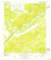
1954 Map of Kantishna River D-3
USGS Topo · Published 1956About this map
The Tanana River dominates this interior Alaska landscape as it was documented in the mid-1950s, weaving through a complex network of braids and islands. The expansive Vachon Island sits centrally in the river's path, flanked to the north by the prominent Cosna Bluff. This survey captures the transition from the high elevations of Bean Ridge and Mooseheart Mtn down into the active alluvial floodplain, where seasonal water movement is recorded in the forms of Patterson Slough and Williams Slough.
Find a feature on this map
13 named features on this map. Tap any name to fly to it.
Don’t see what you’re looking for? This feature index may not catch every label — zoom into the map to look around manually.
Map Details
Editions of this 1954 Kantishna River D-3 Map
This is the sole edition of this map. No revisions or reprints were ever made.
Other maps of this area

1948 · Kantishna River
USGS Topo · 1:250,000

1951 · Kantishna River
USGS Topo · 1:250,000

1951 · Tanana
USGS Topo · 1:250,000

1952 · Tanana A-3
USGS Topo · 1:63,360

1952 · Tanana A-2
USGS Topo · 1:63,360

1952 · Tanana A-4
USGS Topo · 1:63,360

1952 · Kantishna River
USGS Topo · 1:250,000

1952 · Kantishna River D-2
USGS Topo · 1:63,360

1952 · Kantishna River D-3
USGS Topo · 1:63,360

1952 · Kantishna River C-3
USGS Topo · 1:63,360