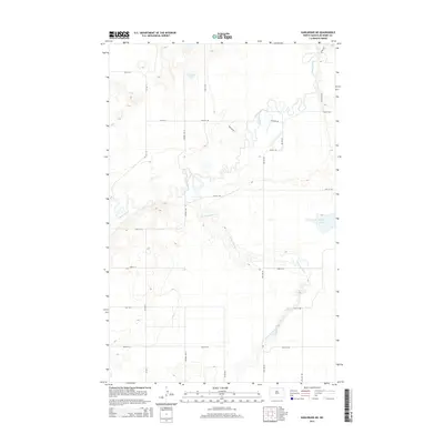
2014 Map of Karlsruhe NE
USGS Topo · Published 2014About this map
The Souris River and its meandering valley dominate this North Dakota landscape, where the water course carves a complex path through McHenry County. This 2014 survey reveals the hydrological intersection where the Wintering River feeds into the larger Souris system from the south, creating a wide riparian corridor characterized by dramatic oxbows and marshy lowlands. Away from the river bottoms, the terrain is defined by the high-latitude prairie, punctuated by bodies of water like Poison Lake in the north and Heffner Lake on the eastern edge. The map documents a rigid section-line road network, including Park Way NE and 55th Pky NE, which highlights the systematic agricultural division of the land typical of the Great Plains, even as the rivers' natural contours defy that geometric order.
Find a feature on this map
25 named features on this map. Tap any name to fly to it.
Don’t see what you’re looking for? This feature index may not catch every label — zoom into the map to look around manually.
Map Details
Editions of this 2014 Karlsruhe NE Map
This is the sole edition of this map. No revisions or reprints were ever made.
Other maps of this area

1949 · Riga
USGS Topo · 1:24,000

1949 · Karlsruhe NW
USGS Topo · 1:24,000

1949 · Denbigh
USGS Topo · 1:24,000

1950 · Karlsruhe NE
USGS Topo · 1:24,000

1950 · Towner
USGS Topo · 1:24,000

1950 · Denbigh
USGS Topo · 1:24,000

1954 · Minot
USGS Topo · 1:250,000

1955 · Rangeley NW
USGS Topo · 1:24,000

1957 · Bergen
USGS Topo · 1:24,000

1957 · Karlsruhe
USGS Topo · 1:24,000