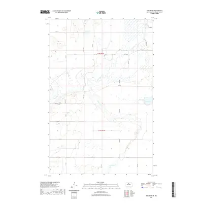
2020 Map of Karlsruhe NE
USGS Topo · Published 2020About this map
The Souris River meanders across this McHenry County landscape, joined by the Wintering River in a region defined by its complex glacial hydrology. The terrain is marked by numerous wetlands and small basins, including Poison Lake to the north and Heffner Lake in the east. This 2020 data captures the rural character of the northern plains, where the rectilinear grid of section roads like 57th St N and 50th St NE overlays the winding natural waterways. For those researching local family history, the Norway Lutheran Cem stands as a significant landmark of the area's early settlement. The map provides a clear view of the agricultural divisions between Township 155 North and Township 154 North, illustrating how the land has been managed and partitioned in relation to the river valley.
Find a feature on this map
21 named features on this map. Tap any name to fly to it.
Don’t see what you’re looking for? This feature index may not catch every label — zoom into the map to look around manually.
Map Details
Editions of this 2020 Karlsruhe NE Map
This is the sole edition of this map. No revisions or reprints were ever made.
Other maps of this area

1949 · Riga
USGS Topo · 1:24,000

1949 · Karlsruhe NW
USGS Topo · 1:24,000

1949 · Denbigh
USGS Topo · 1:24,000

1950 · Karlsruhe NE
USGS Topo · 1:24,000

1950 · Towner
USGS Topo · 1:24,000

1950 · Denbigh
USGS Topo · 1:24,000

1954 · Minot
USGS Topo · 1:250,000

1955 · Rangeley NW
USGS Topo · 1:24,000

1957 · Bergen
USGS Topo · 1:24,000

1957 · Karlsruhe
USGS Topo · 1:24,000