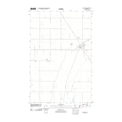
2010 Map of Karlstad
USGS Topo · Published 2010About this map
Karlstad serves as the primary hub in this Kittson County landscape, situated at a major intersection of local routes and rails. The town layout is clearly defined, featuring the Karlstad Post Office and the Karlstad Municipal Moose Park Campground near the northern edge of the settlement. The surrounding prairie is segmented by an orderly grid of township roads and agricultural fields, revealing a rural economy tied to the land and regional transport. To the south, the Tamarac River meanders through the terrain, providing a natural break in the geometric regularity of the surveyed plots.
Find a feature on this map
28 named features on this map. Tap any name to fly to it.
Don’t see what you’re looking for? This feature index may not catch every label — zoom into the map to look around manually.
Map Details
Editions of this 2010 Karlstad Map
This is the sole edition of this map. No revisions or reprints were ever made.
Other maps of this area

1919 · Pelan
USGS Topo · 1:62,500

1952 · Thief River Falls
USGS Topo · 1:250,000

1956 · Thief River Falls
USGS Topo · 1:250,000

1956 · Karlstad
USGS Topo · 1:62,500

1956 · Florian
USGS Topo · 1:62,500

1957 · Thief River Falls
USGS Topo · 1:250,000

1957 · Newfolden
USGS Topo · 1:62,500

1957 · Pelan
USGS Topo · 1:62,500

1967 · Thief River Falls
USGS Topo · 1:250,000
1982 · Pelan
USGS Topo · 1:24,000