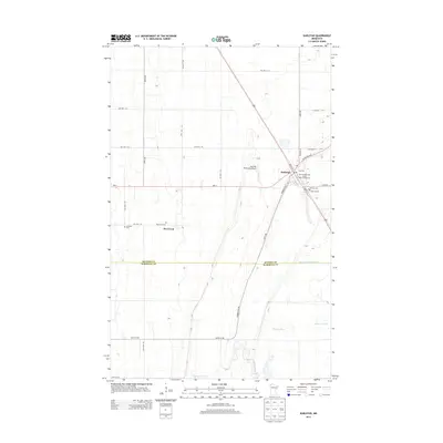
2013 Map of Karlstad
USGS Topo · Published 2013About this map
Karlstad serves as the primary hub of this Kittson County landscape, situated where MN-11 intersects the historic corridor of the Pembina Trl NW. The town is well-documented with its Po, Karlstad Municipal Airport, and the Karlstad Municipal Moose Park Campground. For those tracing family histories, several burial grounds are scattered across the region, including Karlstad Cem, Pearson Cem, and the more isolated Lundeby Cem and Deerwood Cem near the small settlement of Deerwood. The southern portion of the map is defined by the winding course of the Tamarac River and the artificial drainage of Lateral Ditch Number Five, illustrating the complex water management required in this flat, prairie-fringe environment. A dense network of township roads, such as TWP HWY T-52 and TWP HWY T-51, divide the land into a precise grid typical of the Red River Valley's agricultural development.
Find a feature on this map
35 named features on this map. Tap any name to fly to it.
Don’t see what you’re looking for? This feature index may not catch every label — zoom into the map to look around manually.
Map Details
Editions of this 2013 Karlstad Map
This is the sole edition of this map. No revisions or reprints were ever made.
Other maps of this area

1919 · Pelan
USGS Topo · 1:62,500

1952 · Thief River Falls
USGS Topo · 1:250,000

1956 · Thief River Falls
USGS Topo · 1:250,000

1956 · Karlstad
USGS Topo · 1:62,500

1956 · Florian
USGS Topo · 1:62,500

1957 · Thief River Falls
USGS Topo · 1:250,000

1957 · Newfolden
USGS Topo · 1:62,500

1957 · Pelan
USGS Topo · 1:62,500

1967 · Thief River Falls
USGS Topo · 1:250,000
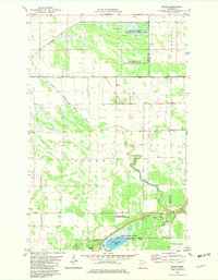
1982 · Pelan
USGS Topo · 1:24,000