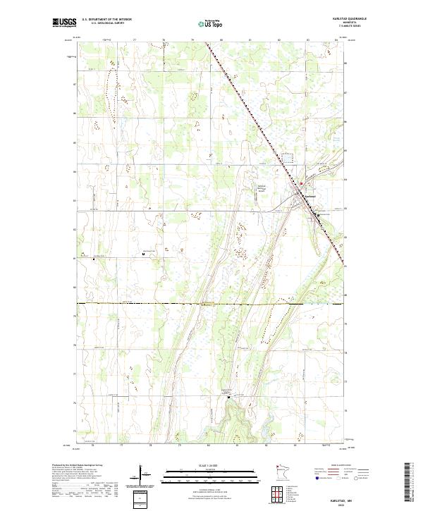
2022 Map of Karlstad
USGS Topo · Published 2022About this map
Karlstad serves as the primary hub in this corner of northwestern Minnesota, situated at the junction of several critical regional transit corridors near the border of Kittson and Marshall counties. The landscape is defined by the low-lying glacial plains of the Red River Valley, where the Tamarac River and Lateral Ditch Number Five manage the hydrology of the surrounding wetlands, including the Twistal Swamp. For family historians, the sheet is exceptionally detailed, noting the Karlstad Cem, Pearson Cem, and the Hegland Free Lutheran Church Cem to the south. The presence of the Pembina Trl NW suggests the enduring path of the Red River Trails, early oxcart routes that once connected the Red River Colony with the Mississippi River, later formalized into the modern road network.
Find a feature on this map
46 named features on this map. Tap any name to fly to it.
Don’t see what you’re looking for? This feature index may not catch every label — zoom into the map to look around manually.
Map Details
Editions of this 2022 Karlstad Map
This is the sole edition of this map. No revisions or reprints were ever made.
Other maps of this area

1919 · Pelan
USGS Topo · 1:62,500

1952 · Thief River Falls
USGS Topo · 1:250,000

1956 · Thief River Falls
USGS Topo · 1:250,000

1956 · Karlstad
USGS Topo · 1:62,500

1956 · Florian
USGS Topo · 1:62,500

1957 · Thief River Falls
USGS Topo · 1:250,000

1957 · Newfolden
USGS Topo · 1:62,500

1957 · Pelan
USGS Topo · 1:62,500

1967 · Thief River Falls
USGS Topo · 1:250,000
1982 · Pelan
USGS Topo · 1:24,000