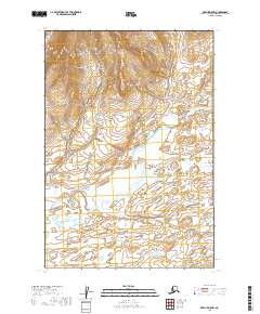
2019 Map of Karluk D-5 NW
USGS Topo · Published 2019About this map
The Becharof National Wildlife Refuge encompasses nearly the entire landscape shown in this 2019 survey of the Alaska Peninsula. The terrain is defined by the prominent Kejulik Mountains in the northern reach, which transition into a complex network of wetlands and tundra to the south. Central to the area’s hydrology is the Kejulik River, which winds across the quadrangle, joined by the E Fork Kejulik River and the smaller Albert Cr as they drain toward the Becharof Lake basin. This map captures a pristine wilderness area where modern infrastructure is entirely absent, characterized instead by significant elevation changes and the natural migration of river channels. It provides a detailed view of the township and range lines, such as t26s r38w, that define these remote public land boundaries.
Find a feature on this map
11 named features on this map. Tap any name to fly to it.
Don’t see what you’re looking for? This feature index may not catch every label — zoom into the map to look around manually.
Map Details
Editions of this 2019 Karluk D-5 NW Map
This is the sole edition of this map. No revisions or reprints were ever made.
Other maps of this area

1948 · Mt Katmai
USGS Topo · 1:250,000

1951 · Mt Katmai
USGS Topo · 1:250,000

1951 · Karluk
USGS Topo · 1:250,000

1951 · Mount Katmai A-6
USGS Topo · 1:63,360

1951 · Karluk D-6
USGS Topo · 1:63,360

1951 · Karluk D-5
USGS Topo · 1:63,360

1951 · Mount Katmai A-5
USGS Topo · 1:63,360

1952 · Karluk
USGS Topo · 1:250,000

1964 · Mt. Katmai
USGS Topo · 1:250,000

1964 · Karluk
USGS Topo · 1:250,000