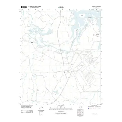
2010 Map of Karnack
USGS Topo · Published 2010About this map
Big Cypress Bayou and its intricate network of lakes, sloughs, and chutes dominate this Harrison County landscape, defining the character of East Texas near the Louisiana border. The town of Karnack serves as the primary hub, with local roads like T J Taylor Ave and State Loop 449 connecting the residential center to the surrounding wetlands. Further north, the uniquely named settlement of Uncertain sits along the water's edge, adjacent to Fly-N-Fish Lodge Airport and the sprawling Goose Prairie.
Find a feature on this map
71 named features on this map. Tap any name to fly to it.
Don’t see what you’re looking for? This feature index may not catch every label — zoom into the map to look around manually.
Map Details
Editions of this 2010 Karnack Map
This is the sole edition of this map. No revisions or reprints were ever made.
Other maps of this area

1944 · Kildare
USGS Topo · 1:62,500

1944 · Caddo Lake
USGS Topo · 1:62,500

1946 · Caddo Lake
USGS Topo · 1:62,500

1948 · Kildare
USGS Topo · 1:62,500

1956 · Tyler
USGS Topo · 1:250,000
1962 · Trees
USGS Topo · 1:24,000

1962 · Woodlawn
USGS Topo · 1:24,000
1962 · Smithland
USGS Topo · 1:24,000

1962 · Jefferson
USGS Topo · 1:24,000
1962 · Potters Point
USGS Topo · 1:24,000