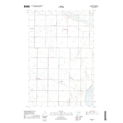
2018 Map of Karnak
USGS Topo · Published 2018About this map
Karnak sits at the heart of this prairie landscape in Griggs County, defined by a grid of agricultural section lines and rural connectors like Griggs Co 22 and Griggs Co 26. The eastern edge of the quadrangle is dominated by the winding course of the Sheyenne River, which flows into the northern reaches of Lake Ashtabula. This transition from the flat agricultural plains to the river valley provides a clear view of the region's hydrography and its influence on local land use. For those tracing the area's social history, several small landmarks offer important grounding, including the Saron Evangelical Cem and Union Cem. Modern recreation is represented by the N Country National Scenic Trail, which traces the eastern bluffs overlooking the river valley, following the natural contours of the Sheyenne's path.
Find a feature on this map
19 named features on this map. Tap any name to fly to it.
Don’t see what you’re looking for? This feature index may not catch every label — zoom into the map to look around manually.
Map Details
Editions of this 2018 Karnak Map
This is the sole edition of this map. No revisions or reprints were ever made.
Other maps of this area

1952 · Grand Forks
USGS Topo · 1:250,000

1952 · New Rockford
USGS Topo · 1:250,000

1956 · New Rockford
USGS Topo · 1:250,000

1956 · Grand Forks
USGS Topo · 1:250,000

1961 · Cooperstown East
USGS Topo · 1:24,000

1961 · Hannaford
USGS Topo · 1:24,000

1961 · Cooperstown West
USGS Topo · 1:24,000

1961 · Dazey NE
USGS Topo · 1:24,000

1961 · Dazey
USGS Topo · 1:24,000

1961 · Karnak
USGS Topo · 1:24,000