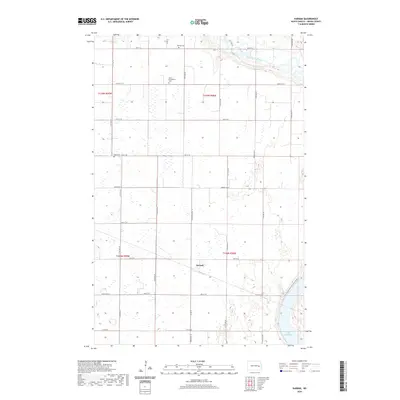
2020 Map of Karnak
USGS Topo · Published 2020About this map
Karnak sits at the heart of this Griggs County landscape, surrounded by the high plains of eastern North Dakota. The area's spiritual and community history is marked by several burial grounds, including the Union Cem and the Saron Evangelical Cem, which stand as landmarks for local genealogy. To the northeast, the Sheyenne River cuts through the terrain, eventually feeding into Lake Ashtabula at the southeastern edge of the survey. The mapping also highlights the route of the N Country National Scenic Trail as it follows the river valley. This quadrangle shows a classic prairie settlement pattern, where section roads like 9th St SE and 117th Ave SE create a geometric grid over a landscape dotted with numerous small wetlands and seasonal ponds.
Find a feature on this map
31 named features on this map. Tap any name to fly to it.
Don’t see what you’re looking for? This feature index may not catch every label — zoom into the map to look around manually.
Map Details
Editions of this 2020 Karnak Map
This is the sole edition of this map. No revisions or reprints were ever made.
Other maps of this area

1952 · Grand Forks
USGS Topo · 1:250,000

1952 · New Rockford
USGS Topo · 1:250,000

1956 · New Rockford
USGS Topo · 1:250,000

1956 · Grand Forks
USGS Topo · 1:250,000

1961 · Cooperstown East
USGS Topo · 1:24,000

1961 · Hannaford
USGS Topo · 1:24,000

1961 · Cooperstown West
USGS Topo · 1:24,000

1961 · Dazey NE
USGS Topo · 1:24,000

1961 · Dazey
USGS Topo · 1:24,000

1961 · Karnak
USGS Topo · 1:24,000