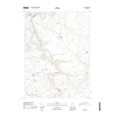
2019 Map of Karthaus
USGS Topo · Published 2019About this map
The West Branch Susquehanna River carves a sharp, deep oxbow through the plateau here, defining the border between Clearfield and Centre counties. This terrain is marked by significant engineering and early community patterns, most notably the Karthaus Tunnel which pierces the narrowest part of the river bend. The landscape is a network of small, isolated settlements and distinct cultural pockets, including the German Settlement to the east and Cooper Settlement to the west.
Find a feature on this map
73 named features on this map. Tap any name to fly to it.
Don’t see what you’re looking for? This feature index may not catch every label — zoom into the map to look around manually.
Map Details
Editions of this 2019 Karthaus Map
This is the sole edition of this map. No revisions or reprints were ever made.
Other maps of this area

1908 · Bellefonte
USGS Topo · 1:62,500

1909 · Bellefonte
USGS Topo · 1:62,500

1922 · Philipsburg
USGS Topo · 1:62,500

1928 · Snow Shoe
USGS Topo · 1:48,000

1929 · Karthaus
USGS Topo · 1:62,500

1931 · Show Shoe
USGS Topo · 1:62,500

1932 · Karthaus
USGS Topo · 1:62,500

1939 · Philipsburg
USGS Topo · 1:62,500

1943 · Lewistown
USGS Topo · 1:125,000

1945 · Philipsburg
USGS Topo · 1:62,500