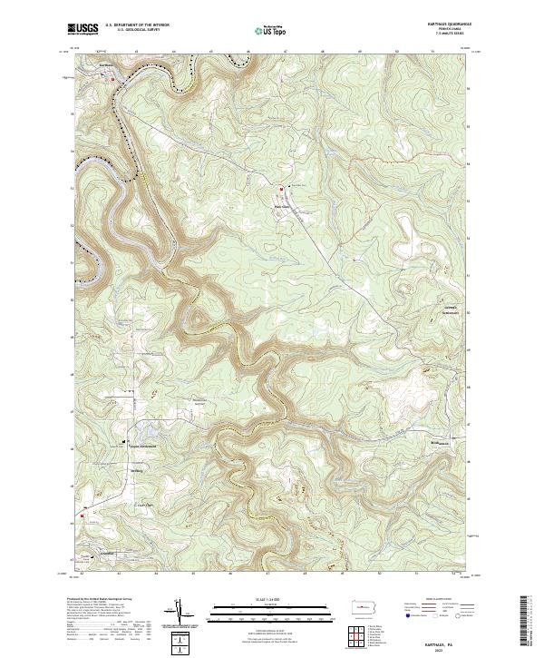
2023 Map of Karthaus
USGS Topo · Published 2023About this map
Karthaus and the surrounding highlands of the Centre Co and Clearfield Co border are defined by the winding course of the West Branch Susquehanna River and its numerous tributaries. The landscape reflects a legacy of upland habitation and logging, with concentrated residential clusters at Pine Glen and the ethnic enclaves of German Settlement and Cooper Settlement. These distinct naming patterns suggest a history of organized land clearing and family-led migration into the central Pennsylvania plateau.
Find a feature on this map
72 named features on this map. Tap any name to fly to it.
Don’t see what you’re looking for? This feature index may not catch every label — zoom into the map to look around manually.
Map Details
Editions of this 2023 Karthaus Map
This is the sole edition of this map. No revisions or reprints were ever made.
Other maps of this area

1908 · Bellefonte
USGS Topo · 1:62,500

1909 · Bellefonte
USGS Topo · 1:62,500

1922 · Philipsburg
USGS Topo · 1:62,500

1928 · Snow Shoe
USGS Topo · 1:48,000

1929 · Karthaus
USGS Topo · 1:62,500

1931 · Show Shoe
USGS Topo · 1:62,500

1932 · Karthaus
USGS Topo · 1:62,500

1939 · Philipsburg
USGS Topo · 1:62,500

1943 · Lewistown
USGS Topo · 1:125,000

1945 · Philipsburg
USGS Topo · 1:62,500