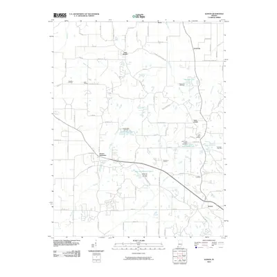
2010 Map of Kasson
USGS Topo · Published 2010About this map
Parkers Settlement and Saint Wendel anchor this rural landscape in southwestern Indiana, where long-established family farming roots are visible through a network of local roads and quiet cemeteries. The map reveals a community defined by its water features and small-scale hamlets, from Saint Joseph in the east to the southern cluster of Kasson. Numerous small reservoirs and dams, such as Edgewater Lake Dam and Mater Dei Provincial Lake, dot the terrain, illustrating the local management of drainage into Little Creek and Neu Creek.
Find a feature on this map
87 named features on this map. Tap any name to fly to it.
Don’t see what you’re looking for? This feature index may not catch every label — zoom into the map to look around manually.
Map Details
Editions of this 2010 Kasson Map
This is the sole edition of this map. No revisions or reprints were ever made.
Other maps of this area

1901 · Haubstadt
USGS Topo · 1:62,500

1903 · Haubstadt
USGS Topo · 1:62,500

1903 · New Harmony
USGS Topo · 1:62,500

1903 · Patoka
USGS Topo · 1:125,000

1914 · Henderson
USGS Topo · 1:48,000

1916 · Henderson
USGS Topo · 1:62,500

1917 · Uniontown
USGS Topo · 1:62,500

1938 · New Harmony
USGS Topo · 1:62,500

1952 · Evansville
USGS Topo · 1:24,000

1954 · Evansville
USGS Topo · 1:250,000