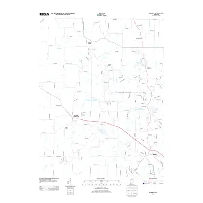
2013 Map of Kasson
USGS Topo · Published 2013About this map
Parkers Settlement and Saint Joseph anchor this rural landscape in southwestern Indiana, characterized by a network of creeks and small residential developments. The area is defined by its transition from traditional agriculture to a more fragmented suburban-rural mix, evidenced by several private aviation strips such as Lockyear Airport and Plugger Airport. Water features are prominent throughout the quadrangle, ranging from the managed waters of Muter Dei Provincial Lake and Edgewater Lake to the drainage networks of Wallenmeyer Ditch and Barr Cr. Small crossroads communities like Saint Wendel and Armstrong maintain their distinct identities amidst a dense web of local roads, including family-named routes like Buente Rd and Diefenbach Rd, which reveal the enduring lineage of local landowners.
Find a feature on this map
158 named features on this map. Tap any name to fly to it.
Don’t see what you’re looking for? This feature index may not catch every label — zoom into the map to look around manually.
Map Details
Editions of this 2013 Kasson Map
This is the sole edition of this map. No revisions or reprints were ever made.
Other maps of this area

1901 · Haubstadt
USGS Topo · 1:62,500

1903 · Haubstadt
USGS Topo · 1:62,500

1903 · New Harmony
USGS Topo · 1:62,500

1903 · Patoka
USGS Topo · 1:125,000

1914 · Henderson
USGS Topo · 1:48,000

1916 · Henderson
USGS Topo · 1:62,500

1917 · Uniontown
USGS Topo · 1:62,500

1938 · New Harmony
USGS Topo · 1:62,500

1952 · Evansville
USGS Topo · 1:24,000

1954 · Evansville
USGS Topo · 1:250,000