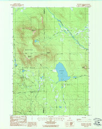
1988 Map of Katahdin Lake
USGS Topo · Published 1988About this map
Baxter State Park dominates the landscape of this 1988 survey, showcasing the complex topography of the Maine wilderness before modern shifts in park management. The map centers on the significant waters of Katahdin Lake, where Katahdin Lake Camps provides a point of human settlement amidst the peaks. The terrain is defined by a series of prominent elevations, including North Turner Mountain, South Turner Mountain, and East Turner Mountain, which dictate the drainage patterns of the Wassataquoik Stream and its numerous tributaries. Geographers and historians can trace the intricate network of water bodies such as Whidden Ponds, Sandy Stream Pond, and Martin Ponds, alongside established recreation sites like the Roaring Brook Campground. This representation captures the intersection of designated park boundaries and the vast, undeveloped townships of Penobscot and Piscataquis counties.
Find a feature on this map
33 named features on this map. Tap any name to fly to it.
Don’t see what you’re looking for? This feature index may not catch every label — zoom into the map to look around manually.
Map Details
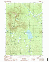
Editions of this 1988 Katahdin Lake Map
2 editions found
Other maps of this area

1927 · Katahdin
USGS Topo · 1:48,000

1930 · Katahdin
USGS Topo · 1:62,500

1949 · Katahdin
USGS Topo · 1:62,500

1953 · Stacyville
USGS Topo · 1:62,500

1954 · Shin Pond
USGS Topo · 1:62,500

1954 · Presque Isle
USGS Topo · 1:250,000

1954 · Millinocket
USGS Topo · 1:250,000

1955 · Traveler Mountain
USGS Topo · 1:62,500

1958 · Presque Isle
USGS Topo · 1:250,000

1958 · Millinocket
USGS Topo · 1:250,000