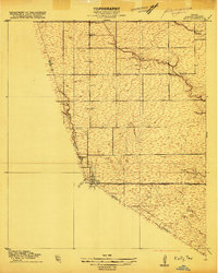
1915 Map of Katy
USGS Topo · Published 1915About this map
Katy serves as the focal point of this 1915 survey, situated at the junction of Harris, Waller, and Fort Bend counties. The landscape is defined by the early regional transportation network, specifically the Missouri-Kansas and Texas railroad and the intersection of Hockley Road and Stockdick Road. This era reveals a rural community supported by local institutions like the South Mayde School and water management features such as Hagars Dam on Cypress Creek. The intricate drainage patterns of South Mayde Creek, Stockdick Creek, and Cane Island Bayou suggest the hydrology of the Texas prairie before modern flood control and suburban development reshaped the area. Genealogists and historians can trace original land boundaries and elevation markers across these three county lines as they appeared during the early 20th century.
Find a feature on this map
17 named features on this map. Tap any name to fly to it.
Don’t see what you’re looking for? This feature index may not catch every label — zoom into the map to look around manually.
Map Details
Editions of this 1915 Katy Map
3 editions found
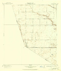
Other maps of this area

1915 · Cypress
USGS Topo · 1:24,000

1915 · Katy
USGS Topo · 1:24,000

1915 · Addicks
USGS Topo · 1:24,000

1915 · Clodine
USGS Topo · 1:24,000

1916 · Swanson
USGS Topo · 1:24,000

1918 · Cypress
USGS Topo · 1:31,680

1918 · Addicks
USGS Topo · 1:31,680

1919 · Clodine
USGS Topo · 1:31,680

1919 · Swanson
USGS Topo · 1:31,680

1950 · Houston
USGS Topo · 1:250,000