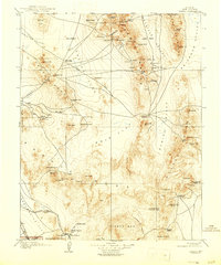
1908 Map of Kawich
USGS Topo · Published 1946About this map
Kawich Range and the high desert basins of Nye County define this 1905 survey, reflecting a peak era of mining exploration across southern Nevada. Scattered mining camps and remote outposts such as Silverbow, Golden Arrow, and Trappmans Camp underscore the transient but intense search for minerals in these desolate ranges. In the southern reaches of the map, the Bullfrog district and the L V and T R R railroad mark the infrastructure of the booming gold industry, while agricultural interests are represented by the Howell Ranch and Longstreets Ranch. The landscape is a network of vital water sources like Cedar Wells and Antelope Sprs, which were essential for both the prospecting parties and the early Auto Road travel through Cactus Flat. This record documents the region just before many of these camps faded and as the southern portion of the area was being incorporated into the Death Valley National Monument.
Find a feature on this map
90 named features on this map. Tap any name to fly to it.
Don’t see what you’re looking for? This feature index may not catch every label — zoom into the map to look around manually.
Map Details
Editions of this 1908 Kawich Map
3 editions found
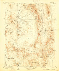
Other maps of this area

1907 · Tonopah
USGS Topo · 1:250,000

1907 · Las Vegas
USGS Topo · 1:250,000

1908 · Kawich
USGS Topo · 1:250,000

1908 · Lida
USGS Topo · 1:250,000

1908 · Furnace Creek
USGS Topo · 1:250,000

1908 · Las Vegas
USGS Topo · 1:250,000

1908 · Tonopah
USGS Topo · 1:250,000

1908 · Ballarat
USGS Topo · 1:250,000

1910 · Furnace Creek
USGS Topo · 1:250,000

1913 · Lida
USGS Topo · 1:250,000