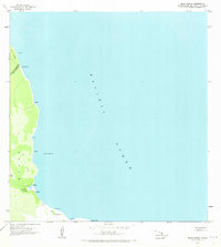
1963 Map of Keaau Ranch
USGS Topo · Published 1973About this map
The agricultural and coastal boundary between the South Hilo District and Puna District is defined here by the lush lands of Keaau and Waiakea. Centered on the operational hub of Keaau Ranch, the landscape reveals an economy built on local cultivation, notably at the Keaau Orchard near the coast. A network of unimproved roads and a coastal Trail provide the only access to the rocky shoreline, connecting isolated points such as Haena and Anapuka.
Find a feature on this map
21 named features on this map. Tap any name to fly to it.
Don’t see what you’re looking for? This feature index may not catch every label — zoom into the map to look around manually.
Map Details
Editions of this 1963 Keaau Ranch Map
2 editions found
Other maps of this area

1915 · Honomu
USGS Topo · 1:62,500

1917 · Hilo
USGS Topo · 1:62,500

1924 · Makuu
USGS Topo · 1:62,500

1932 · Hilo
USGS Topo · 1:62,500

1954 · Hawaii North
USGS Topo · 1:250,000

1959 · Hawaii North
USGS Topo · 1:250,000

1961 · Hawaii North
USGS Topo · 1:250,000
1963 · Hilo
USGS Topo · 1:24,000
1963 · Keaau Ranch
USGS Topo · 1:24,000
1963 · Mountain View
USGS Topo · 1:24,000