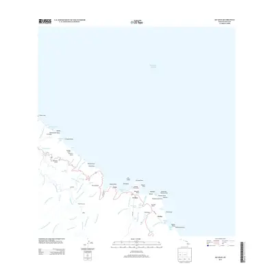
2013 Map of Keanae
USGS Topo · Published 2013About this map
The Ke'anae Peninsula and the settlement of Wailua define this coastal landscape on Maui's windward shore. The topography is marked by a complex system of water management and natural hydrology, featuring the Manuel Luis Ditch and New Hamakua Ditch cutting across the slopes above Honomanu Bay. This area illustrates the intersection of traditional land use and early 20th-century utility development, evidenced by the Kōlea Powerhouse and the Old Ke'anae Landing on the shoreline. Numerous waterfalls such as Waikani Falls and Ke'ākū Falls punctuate the steep drainages of the Ke'anae Valley, while smaller settlements like Kailua are connected by the winding path of Highway 360. This map captures a coastal environment where steep gulches and volcanic points like Ke'anae Point meet the Pacific Ocean.
Find a feature on this map
78 named features on this map. Tap any name to fly to it.
Don’t see what you’re looking for? This feature index may not catch every label — zoom into the map to look around manually.
Map Details
Editions of this 2013 Keanae Map
This is the sole edition of this map. No revisions or reprints were ever made.
Other maps of this area

1954 · Maui
USGS Topo · 1:250,000

1957 · Kilohana
USGS Topo · 1:24,000

1957 · Hana
USGS Topo · 1:24,000

1957 · Haiku
USGS Topo · 1:24,000

1957 · Nahiku
USGS Topo · 1:24,000

1957 · Keanae
USGS Topo · 1:24,000

1966 · Maui
USGS Topo · 1:250,000

1974 · Maui
USGS Topo · 1:250,000

1978 · Hana
USGS Topo · 1:24,000

1983 · Nahiku
USGS Topo · 1:24,000