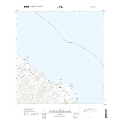
2017 Map of Keanae
USGS Topo · Published 2017About this map
Ke'anae Peninsula defines this section of the Maui coastline, where traditional taro-growing lands meet the Pacific. The landscape is heavily marked by early twentieth-century water engineering, featuring the complex paths of the Manuel Luis Ditch and the New Hāmākua Ditch as they traverse deep gulches. These systems illustrate the era's massive efforts to divert mountain water for leeward agriculture.
Find a feature on this map
76 named features on this map. Tap any name to fly to it.
Don’t see what you’re looking for? This feature index may not catch every label — zoom into the map to look around manually.
Map Details
Editions of this 2017 Keanae Map
This is the sole edition of this map. No revisions or reprints were ever made.
Other maps of this area

1954 · Maui
USGS Topo · 1:250,000

1957 · Kilohana
USGS Topo · 1:24,000

1957 · Hana
USGS Topo · 1:24,000

1957 · Haiku
USGS Topo · 1:24,000

1957 · Nahiku
USGS Topo · 1:24,000

1957 · Keanae
USGS Topo · 1:24,000

1966 · Maui
USGS Topo · 1:250,000

1974 · Maui
USGS Topo · 1:250,000

1978 · Hana
USGS Topo · 1:24,000

1983 · Nahiku
USGS Topo · 1:24,000