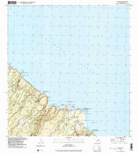
1992 Map of Keanae
USGS Topo · Published 2003About this map
Ke'anae Homesteads and the neighboring Wailua Homesteads define this coastal stretch of Maui during the late twentieth century. Located along the winding Hana Highway, the village of Ke'anae serves as a central hub, where the Old Ke'anae Landing and Waialohe Pond meet the edge of the Pacific Ocean. The landscape is dominated by the steep drainages of the Ko'olau Forest Reserve, where numerous streams like the Palauhulu Stream and Wai'anu Stream feed into the coastal flats.
Find a feature on this map
76 named features on this map. Tap any name to fly to it.
Don’t see what you’re looking for? This feature index may not catch every label — zoom into the map to look around manually.
Map Details
Editions of this 1992 Keanae Map
This is the sole edition of this map. No revisions or reprints were ever made.
Other maps of this area

1954 · Maui
USGS Topo · 1:250,000

1957 · Kilohana
USGS Topo · 1:24,000

1957 · Hana
USGS Topo · 1:24,000

1957 · Haiku
USGS Topo · 1:24,000

1957 · Nahiku
USGS Topo · 1:24,000

1957 · Keanae
USGS Topo · 1:24,000

1966 · Maui
USGS Topo · 1:250,000

1974 · Maui
USGS Topo · 1:250,000

1978 · Hana
USGS Topo · 1:24,000

1983 · Nahiku
USGS Topo · 1:24,000