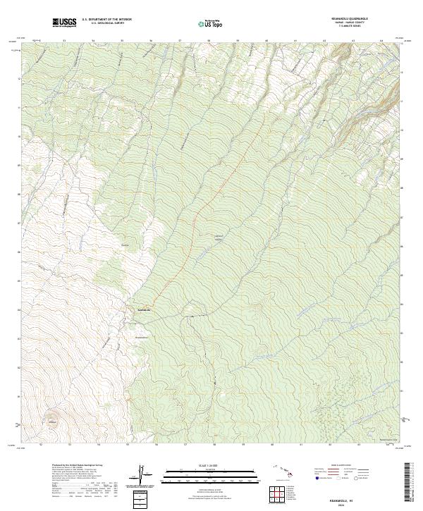
2024 Map of Keanakolu
USGS Topo · Published 2024About this map
Keanakolu sits at a high-elevation junction on the windward slopes of the Island of Hawai'i, where the historic Humuula Trl meets Mana Rd. This survey details a landscape defined by deep gulches and upland forests, notably containing a portion of the Hakalau Forest National Wildlife Refuge in the southeast. The drainage pattern is dense and directional, with countless named waterways like Laupahoehoe Stream and Ka'awali'i Stream cutting through the terrain. Evidence of early land management remains visible through labels like the Niupea Homestead Rd. Topographical landmarks such as Pu'uloa and the prominent Nanamauna Cone provide clear reference points for the volcanic character of this region, while small settlements like Pu'ulalohinu and Kalepa mark the few established sites in this remote forest and ranching corridor.
Find a feature on this map
37 named features on this map. Tap any name to fly to it.
Don’t see what you’re looking for? This feature index may not catch every label — zoom into the map to look around manually.
Map Details
Editions of this 2024 Keanakolu Map
This is the sole edition of this map. No revisions or reprints were ever made.
Other maps of this area

1915 · Hamakua
USGS Topo · 1:62,500

1915 · Honomu
USGS Topo · 1:62,500

1954 · Hawaii North
USGS Topo · 1:250,000

1956 · Pua Akala
USGS Topo · 1:24,000

1956 · Keanakolu
USGS Topo · 1:24,000

1956 · Mauna Kea
USGS Topo · 1:24,000

1956 · Umikoa
USGS Topo · 1:24,000

1957 · Kukaiau
USGS Topo · 1:24,000

1957 · Honokaa
USGS Topo · 1:24,000

1959 · Hawaii North
USGS Topo · 1:250,000