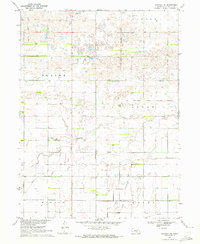
1970 Map of Kearney SE
USGS Topo · Published 1972About this map
The Old Fort Kearney Military Reservation Boundary bisects this prairie landscape, marking the historic extent of the frontier outpost's influence south of the Platte River. In the early 1970s, the terrain shows a transition from the rolling sandhills and natural drainages like Crooked Cr and Lost Creek in the north to the engineered agricultural landscape of the south. This transition is anchored by the Phelps County Canal, which cuts across the lower half of the quadrangle, redirecting water through the flatlands of Mirage and Hayes. The presence of numerous wells and a modern Pipeline alongside older benchmarks like BM 2181 illustrates the evolving relationship between local land use and the Missouri River Basin development programs during this era.
Find a feature on this map
21 named features on this map. Tap any name to fly to it.
Don’t see what you’re looking for? This feature index may not catch every label — zoom into the map to look around manually.
Map Details
Editions of this 1970 Kearney SE Map
This is the sole edition of this map. No revisions or reprints were ever made.
Other maps of this area

1894 · Kearney
USGS Topo · 1:62,500

1894 · Minden
USGS Topo · 1:62,500

1896 · Holdrege
USGS Topo · 1:125,000

1896 · Kearney
USGS Topo · 1:125,000

1896 · Wood River
USGS Topo · 1:125,000

1897 · Red Cloud
USGS Topo · 1:125,000

1955 · Grand Island
USGS Topo · 1:250,000

1957 · Grand Island
USGS Topo · 1:250,000

1958 · Grand Island
USGS Topo · 1:250,000

1962 · Newark
USGS Topo · 1:24,000