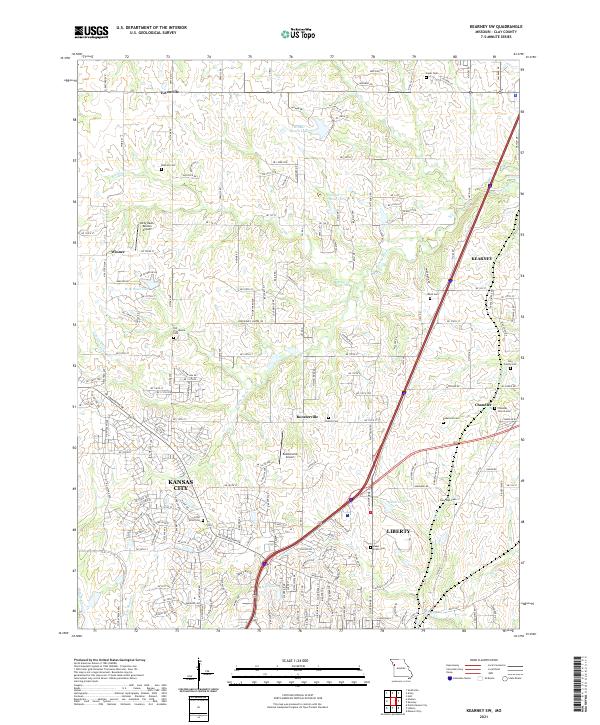
2021 Map of Kearney SW
USGS Topo · Published 2021About this map
Fishing River and Brushy Cr wind through the hills of Clay County, defining a landscape of residential growth and long-established homesteads. While the southern and western portions of the sheet are increasingly absorbed into the suburban fabric of Kansas City and Liberty, the northern reaches retain a more rural character marked by small airfields like Kitty-Hawk Estates Airport and the Roosterville Airport.
Find a feature on this map
77 named features on this map. Tap any name to fly to it.
Don’t see what you’re looking for? This feature index may not catch every label — zoom into the map to look around manually.
Map Details
Editions of this 2021 Kearney SW Map
This is the sole edition of this map. No revisions or reprints were ever made.
Other maps of this area

1890 · Kansas City
USGS Topo · 1:125,000

1894 · Kansas City
USGS Topo · 1:125,000

1894 · Independence
USGS Topo · 1:125,000

1914 · Smithville
USGS Topo · 1:62,500

1935 · Missouri City
USGS Topo · 1:24,000

1935 · North Kansas City
USGS Topo · 1:24,000

1935 · Liberty
USGS Topo · 1:24,000

1936 · Kearney
USGS Topo · 1:48,000

1940 · Liberty
USGS Topo · 1:31,680
1940 · North Kansas City
USGS Topo · 1:31,680