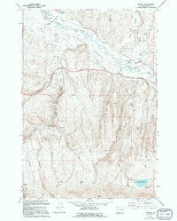
1994 Map of Keating
USGS Topo · Published 1994About this map
The Lower Powder Valley is defined by an intricate network of irrigation channels, tracing the agrarian development of this corner of Baker County. The Powder River feeds numerous named canals, including Tucker Ditch, Keating Ditch, and Perkins Ditch, which support the settlement at Keating. While the valley floor is dominated by water management, the surrounding hills tell a story of extraction, dotted with an Open Pit Mine, a Prospect Well, and various unnamed prospects and gravel pits.
Find a feature on this map
36 named features on this map. Tap any name to fly to it.
Don’t see what you’re looking for? This feature index may not catch every label — zoom into the map to look around manually.
Map Details
Editions of this 1994 Keating Map
This is the sole edition of this map. No revisions or reprints were ever made.
Other maps of this area

1901 · Baker City
USGS Topo · 1:125,000

1915 · Pine
USGS Topo · 1:125,000

1955 · Baker
USGS Topo · 1:250,000

1957 · Sparta
USGS Topo · 1:62,500

1957 · Durkee
USGS Topo · 1:62,500

1959 · Baker
USGS Topo · 1:250,000
1967 · Sawtooth Ridge
USGS Topo · 1:24,000

1967 · Virtue Flat
USGS Topo · 1:24,000

1967 · Encina
USGS Topo · 1:24,000
1967 · Keating
USGS Topo · 1:24,000