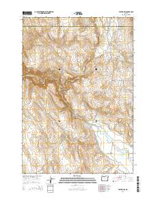
2014 Map of Keating NW
USGS Topo · Published 2014About this map
The Powder River carves a deep path through this section of eastern Oregon, where the high-desert terrain is marked by an extensive network of irrigation infrastructure. This landscape, situated along the Union Co and Baker County line, reveals the complex water management required for ranching and agriculture in the Lower Powder Valley. Significant waterworks such as the Kennedy Ditch, Emele Ditch, and Basche Ditch contour the hillsides, feeding from natural sources like Big Cr and Little Rattlesnake Cr.
Find a feature on this map
36 named features on this map. Tap any name to fly to it.
Don’t see what you’re looking for? This feature index may not catch every label — zoom into the map to look around manually.
Map Details
Editions of this 2014 Keating NW Map
This is the sole edition of this map. No revisions or reprints were ever made.
Other maps of this area

1901 · Baker City
USGS Topo · 1:125,000

1906 · Telocaset
USGS Topo · 1:125,000

1955 · Baker
USGS Topo · 1:250,000

1955 · Grangeville
USGS Topo · 1:250,000

1959 · Baker
USGS Topo · 1:250,000

1959 · Grangeville
USGS Topo · 1:250,000

1965 · Flagstaff Butte
USGS Topo · 1:24,000

1965 · Medical Springs
USGS Topo · 1:24,000
1965 · Telocaset
USGS Topo · 1:24,000
1967 · Sawtooth Ridge
USGS Topo · 1:24,000