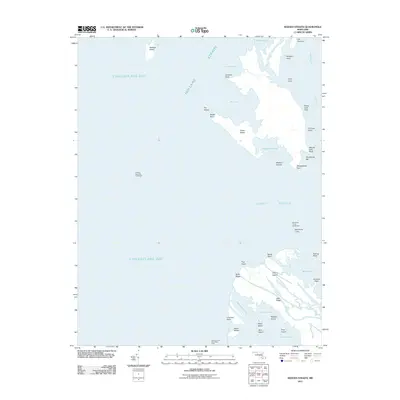
2011 Map of Kedges Straits
USGS Topo · Published 2011About this map
Holland Island and the surrounding marshy archipelagos define this coastal portion of Dorchester County, where the transition between the Chesapeake Bay and Tangier Sound is marked by significant maritime navigational aids. At the center of the Holland Straits, the Holland Island Bar Lighthouse and the Solomons Lump Lighthouse serve as critical markers for vessels navigating the complex network of coves and islands. The landscape is a fragmented collection of named ridges and points, such as Noah Ridge, Joes Ridge, and Pungers Point, reflecting a tidal environment where land and water are constantly intertwined. Numerous protected harbors like Sheepshead Harbor and Sawney Cove cut into the low-lying terrain of Jones Island and Cherry Island, illustrating the unique geography of Maryland's eastern shore island chains during the early 21st century.
Find a feature on this map
43 named features on this map. Tap any name to fly to it.
Don’t see what you’re looking for? This feature index may not catch every label — zoom into the map to look around manually.
Map Details
Editions of this 2011 Kedges Straits Map
This is the sole edition of this map. No revisions or reprints were ever made.
Other maps of this area

1898 · St. Marys
USGS Topo · 1:125,000

1903 · Crisfield
USGS Topo · 1:62,500

1903 · Bloodsworth Island
USGS Topo · 1:62,500

1903 · Deal Island
USGS Topo · 1:62,500

1906 · St. Marys
USGS Topo · 1:125,000

1917 · Ewell
USGS Topo · 1:62,500

1920 · Crisfield
USGS Topo · 1:62,500

1942 · Terrapin Sand Point
USGS Topo · 1:24,000

1942 · Kedges Straits
USGS Topo · 1:24,000

1942 · Ewell
USGS Topo · 1:24,000